20 places, one standard
Destinations
Austral books vetted local photographers, videographers and drone pilots in 20 destinations across Argentina — the capital, the lakes and glaciers of Patagonia, the wine valleys and the northwest — from $110. Each one lives there, and knows which hour a place is still empty and which authority a session there answers to.
20 destinations
Search a destination
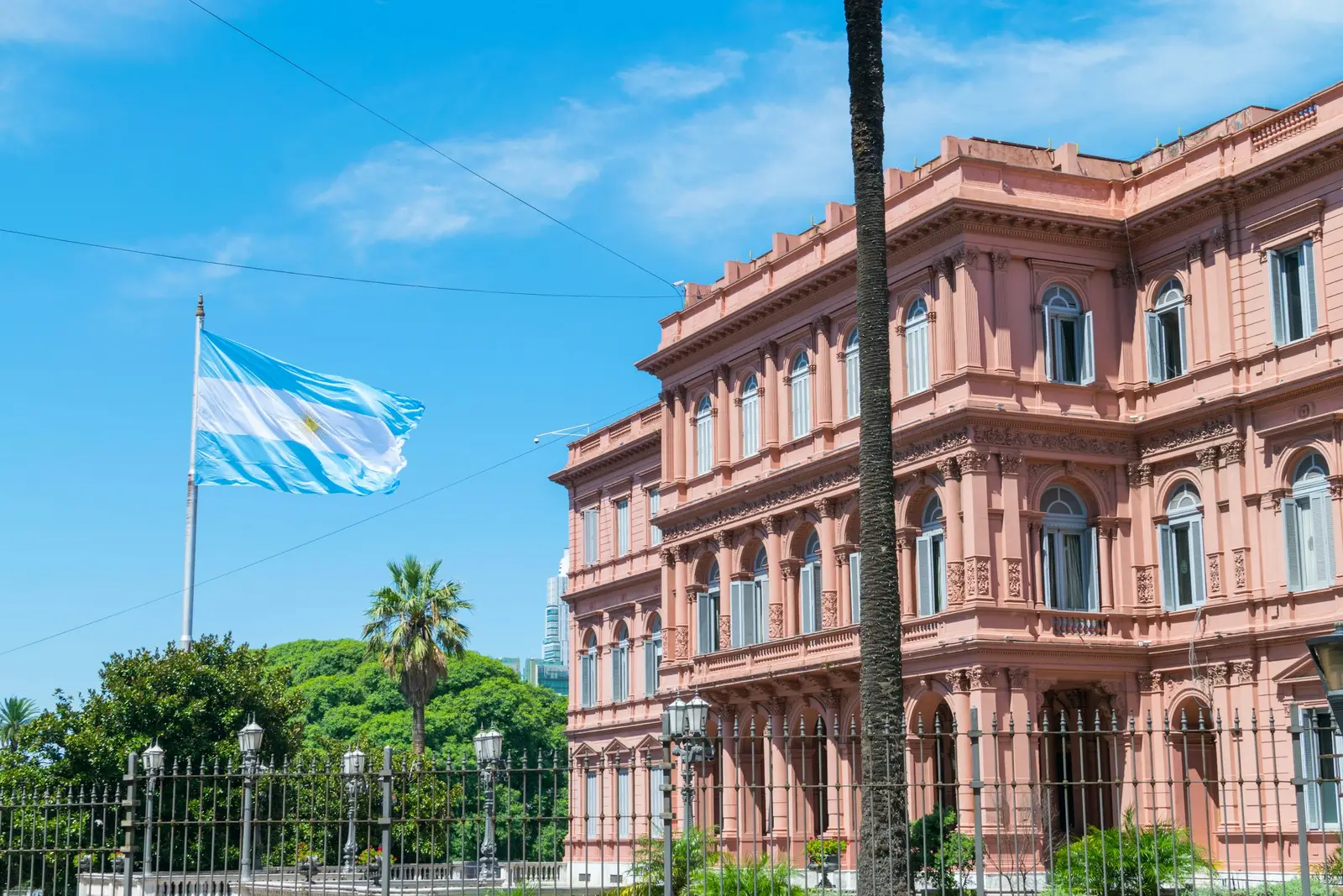
Buenos Aires
Buenos Aires is the capital of Argentina and a self-governing city, the Ciudad Autónoma de Buenos Aires (CABA), of about 200 square kilometres on the western shore of the Río de la Plata. Sessions here are planned by neighbourhood rather than by landmark: Palermo for parks and roses, Recoleta for French-style façades, San Telmo for cobblestones and antique shops, La Boca for painted tin houses, and Puerto Madero for brick docks and glass towers. Most of them are within 30 minutes of each other by car outside rush hour. Public space has one permit office. BASet, part of the city's BA Audiovisual programme, issues a general habilitación that covers filming and photography camera-in-hand with a small crew and no equipment occupying the street, and a separate set permit for anything that does occupy it — stands, reflectors on stands, a table, a lighting kit. A photography set is requested at least 4 business days ahead, the applicant must hold civil-liability insurance that names the city, and the permit papers have to be on hand during the shoot in case of an inspection. We plan most couple and portrait sessions to stay camera-in-hand for exactly this reason. Private ground is a separate matter. Cafés, hotels, milongas, museums and the Jardín Japonés each set their own rule for an outside photographer, and that is asked of the venue in writing before the date. Drones are a third regime: under ANAC's RAAC Part 101, a drone of 250 g to 25 kg flies in the Open category without prior authorization, but never inside an aerodrome control zone, over a person who has not consented, or over the Casa Rosada, embassies and public buildings. Aeroparque Jorge Newbery sits on the city's own riverfront, so aerial work over the city is quoted only after the flight area has been checked against the airspace map. Most clients are travellers from the United States, Canada and Europe on a few nights in the city — couples, proposals, tango sessions and weddings — and Argentine couples and brands who book on the Spanish side.
Explore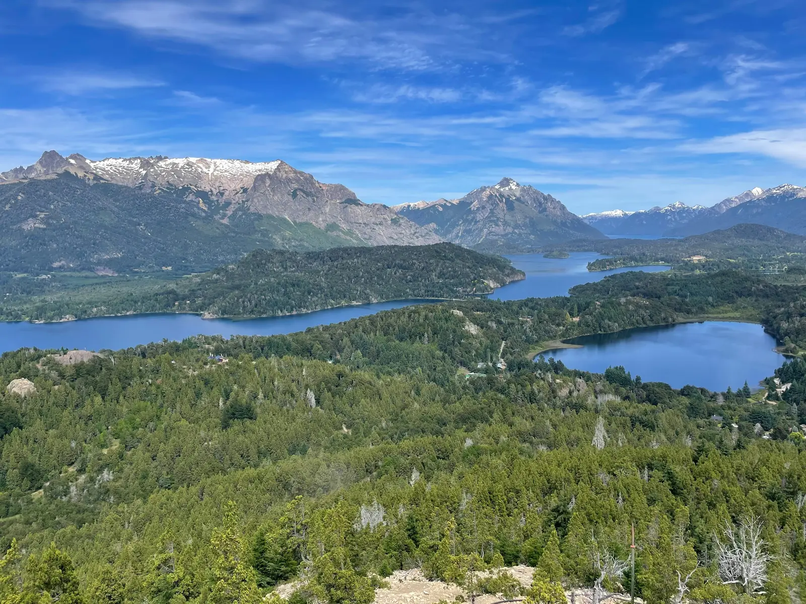
Bariloche
San Carlos de Bariloche is a lakeside city in the Argentine province of Río Negro, built on the southern shore of Lago Nahuel Huapi and surrounded by the Parque Nacional Nahuel Huapi, whose Intendencia stands at San Martín 24 in the city centre. Sessions here are planned around three things: the lake, the mountains above it, and the national-park rules that apply the moment a shoot leaves town. The city has its own stone backdrop. The Centro Cívico, opened on 17 March 1940 and designed by the architect Ernesto de Estrada in cypress, larch and tuff stone from Cerro Carbón, was declared a national historic monument together with the Intendencia de Parques Nacionales by Resolution 1250 of the Secretaría de Cultura in 1987, ratified by Decreto 325 in 1989. West of town, Avenida Exequiel Bustillo runs along the lake to the Cerro Campanario chairlift at km 17.5 and to Puerto Pañuelo at km 25.5, the port built in 1965 in front of the Hotel Llao Llao. The park has a rulebook of its own. The Administración de Parques Nacionales (APN) charges a daily access fee at three points around Bariloche: the Mascardi access on the road to Cerro Tronador, Puerto Pañuelo for the boat trips to Isla Victoria, the Bosque de Arrayanes and Puerto Blest, and the entrance to the Quetrihué peninsula. The APN drone regulation of 2021 prohibits recreational drone use in every national park and requires express prior authorization for any project that flies one. Most clients are couples and families on a week in Patagonia: a proposal at a viewpoint, an engagement session in the snow on Cerro Catedral, a wedding at a lakeside hotel, or a family session on the Circuito Chico. Each private venue — the Hotel Llao Llao, the lodges along Bustillo, the estancias toward the steppe — sets its own policy for outside photographers, and that policy is confirmed in writing before the date.
Explore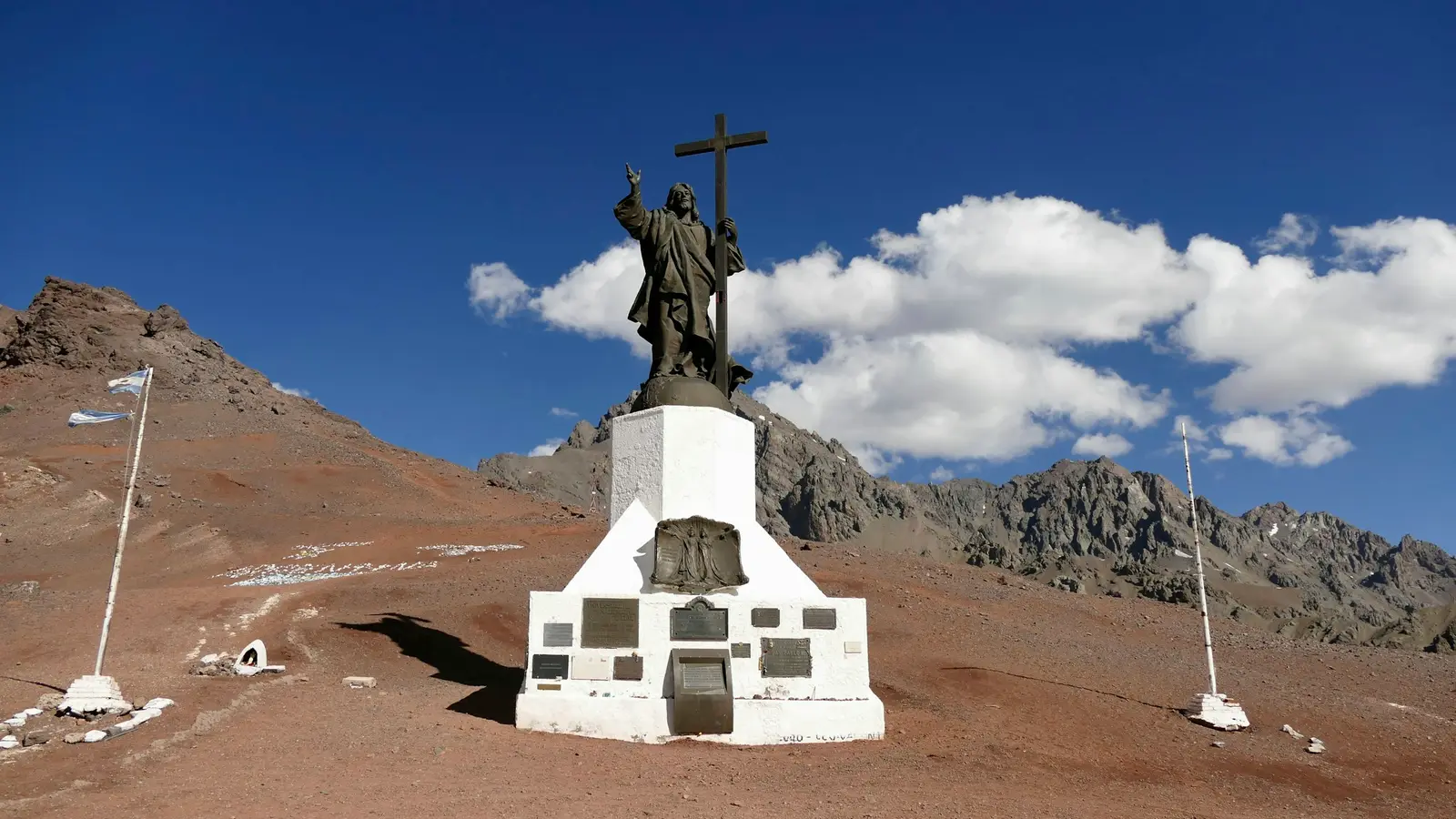
Mendoza
Mendoza is the capital of Mendoza Province, a city built on an irrigated oasis at the foot of the Andes and the centre of Argentina's largest wine region. The Instituto Nacional de Vitivinicultura (INV) recorded 13,147,187 quintales of grapes harvested in the province in 2026, out of 18,391,299 for the whole country. Photo sessions here move between three settings within about an hour of each other: the tree-lined city, the wineries of Luján de Cuyo and Maipú to the south, and the high valleys further out. The city's great outdoor room is Parque General San Martín. Provincial Ley 19 of 6 November 1896 funded it, and the landscape architect Carlos Thays drew the first plans five days later. Today the park covers 307 cultivated hectares plus 86 in expansion, with 17 km of drives, and is a protected urban environmental area. At its western edge the Cerro de la Gloria carries the Monumento al Ejército de los Andes by Juan Manuel Ferrari, built between 1909 and 1914. The Mendoza Film Commission lists the Dirección de Parques y Paseos Públicos as the office that regulates the park, the Cerro de la Gloria and the Parque Cívico, and productions file a written note at its desk on Paseo Los Plátanos. The mountains shape the light. The Andes rise to the west, so the sun drops behind them before it reaches the horizon, and the last half hour of the day is shade with a bright sky rather than a long golden glow. Mornings are clear and hard. Most portrait sessions in the city are therefore planned for the first two hours after sunrise or the hour before the sun meets the ridge. Most clients are on a wine trip: couples marrying or celebrating at a bodega, families on a week in wine country, and hotels and wineries commissioning their own pictures. Every winery is private and sets its own rules for outside photographers, which are confirmed with the venue in writing before the date. The Valle de Uco, where the newer high-altitude vineyards are, is roughly an hour to an hour and a half south by road.
Explore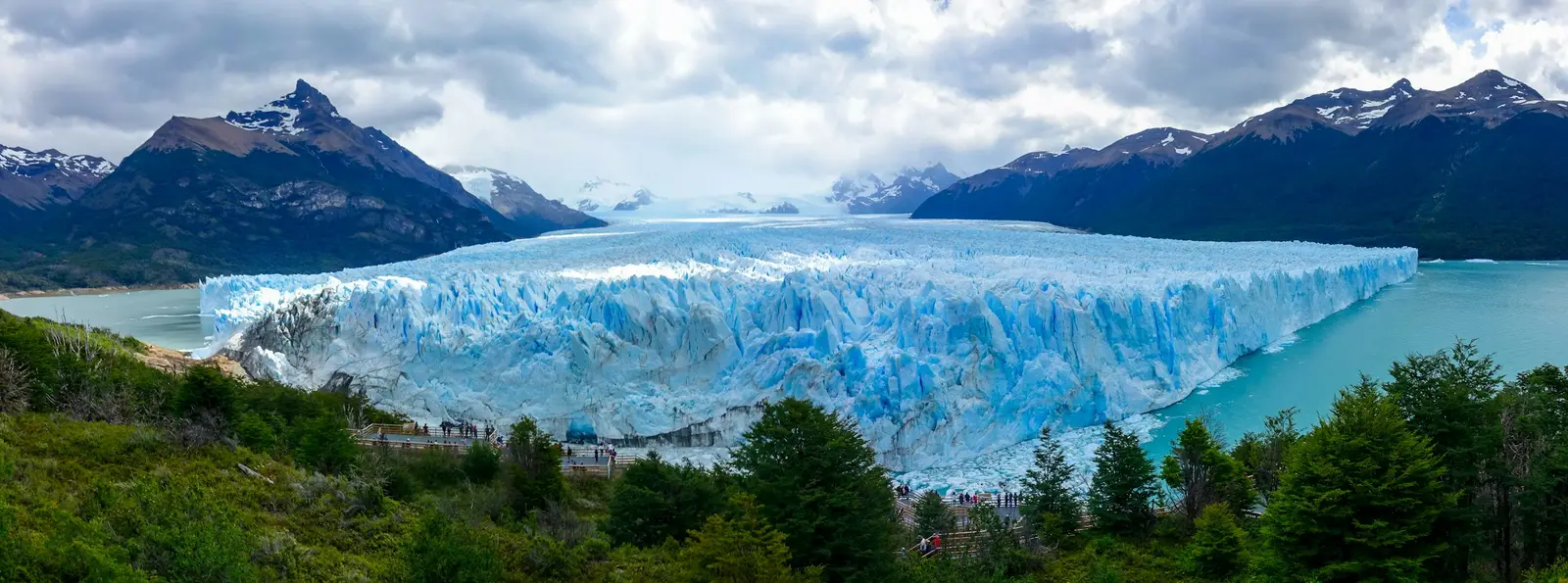
El Calafate
El Calafate is a town on the southern shore of Lago Argentino in Santa Cruz province, and the gateway to the southern sector of Parque Nacional Los Glaciares. The park was created in 1937, declared a UNESCO World Heritage Site in 1981, and covers 726,927 hectares, which makes it the largest park in the Argentine protected-areas system. Almost half of that surface is ice fed by the Southern Patagonian Ice Field, an ice sheet of about 12,500 km² shared with Chile. The glacier most sessions are built around is the Perito Moreno, a tongue of ice of 254 km² that ends in Lago Argentino across from the Península de Magallanes. The Administración de Parques Nacionales (APN) has laid six walkway circuits on the peninsula facing the ice, from the 150 m Sendero de los Témpanos to the 1,117 m Sendero de la Costa, with balconies at several heights. Ice breaks off the front through the day, and the noise arrives before the splash, so a photographer here works on long waits and fast reactions rather than on a fixed pose. Two park rules decide how a session is planned. Drones are prohibited throughout Los Glaciares, so every aerial is flown outside the park boundary, and the walkways keep fixed opening hours, so the glacier is a daylight location. Lago Argentino sits only 177 m above sea level, and the air at the ice is cold and often wet even in January. Most clients come for two to four nights: couples and honeymooners who want the glacier, travellers combining it with El Chaltén 220 km to the north, and a few small elopements. The town itself gives a second set of backdrops, from the Bahía Redonda shoreline to the steppe that starts at the last street.
Explore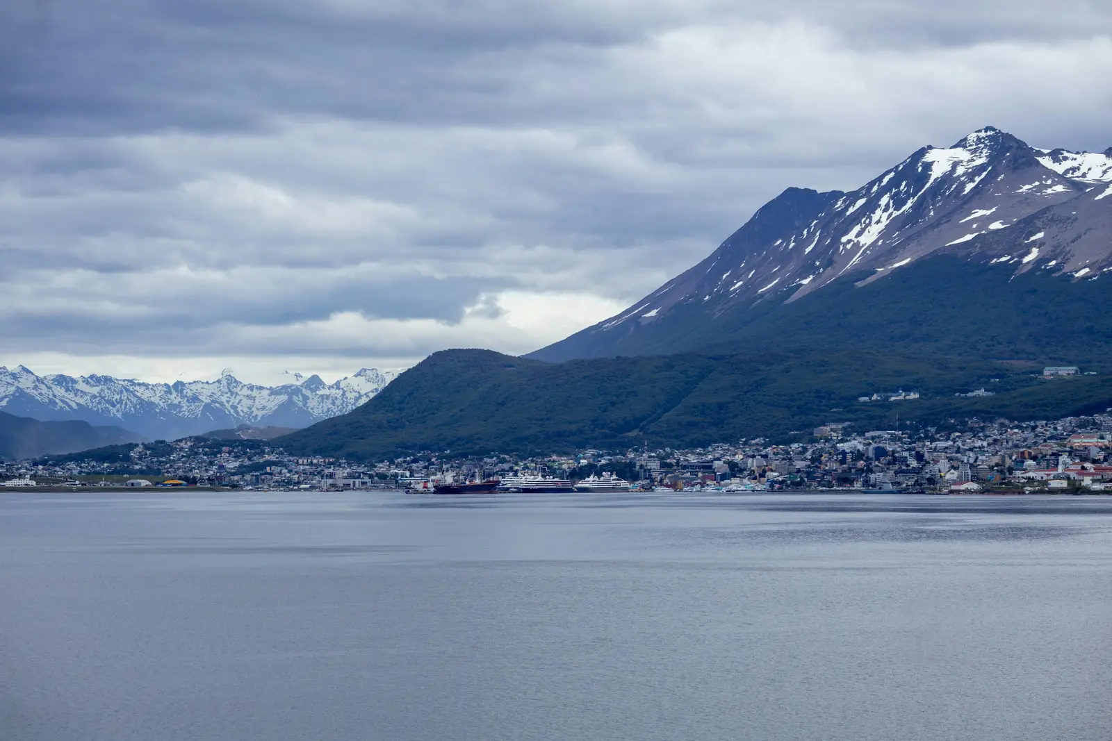
Ushuaia
Ushuaia is the capital of Tierra del Fuego province, a port city built on the north shore of the Beagle Channel between the water and the Martial mountains. It is the starting point for the Antarctic cruise season and for most travel in Argentine Tierra del Fuego, and the light here behaves like nowhere else in the country: long, low and slow in summer, brief and pale in winter. The main natural backdrop is Parque Nacional Tierra del Fuego, created in 1960 by Law 15,554, whose entrance on Ruta Nacional 3 is 12 km west of the city centre. The park protects 68,909 hectares of the southern end of the Andes, and its visitor information notes that it is the only place in Argentina where the Andean-Patagonian forest reaches the sea. It is open from 8:30 to 20:00, and the Administración de Parques Nacionales (APN) asks visitors not to enter at night. Overflights of any kind, drones included, are prohibited throughout the park, and boats on its lakes and rivers run only with authorised companies. The other backdrop is the channel itself. The municipal tourism office lists catamaran, yacht and sailboat excursions with professional guides to the islands of the Beagle, where cormorants and sea lions live, and to the Faro Les Eclaireurs, a lighthouse about 20 km from the city. Puerto Almanza, a fishing village 75 km east on the same coast, is known for its king crab. Clients here are mostly travellers on a once-in-a-lifetime trip, often on the way to or from Antarctica: couples, honeymooners, families and small adventure elopements. The weather changes fast at 55° south, and every session carries a plan for wind and rain.
Explore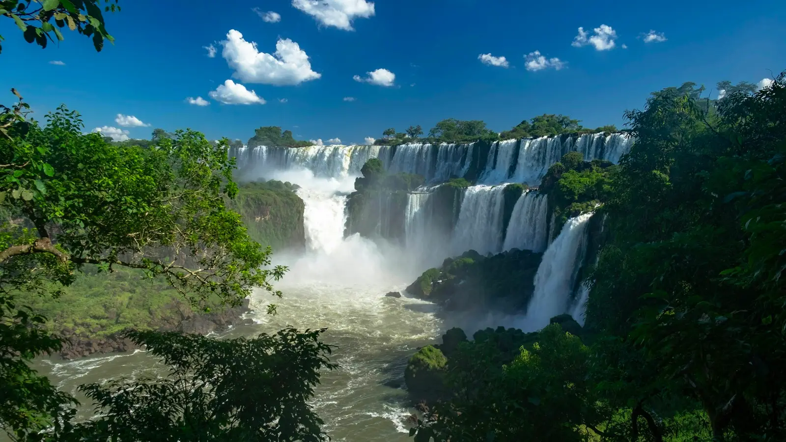
Puerto Iguazú
Puerto Iguazú is a town in the province of Misiones, in the far northeast of Argentina, at the point where the Iguazú River meets the Paraná and three countries face each other across the water: Argentina, Brazil and Paraguay. It lies 18 km from the entrance of the Parque Nacional Iguazú, and its international airport receives flights from Buenos Aires. Nearly every session booked here is built around the falls. The park was created in 1934, inscribed by UNESCO as a World Heritage Site in 1984, and protects more than 67,000 hectares of Paraná rainforest. The Administración de Parques Nacionales (APN) runs three walkway circuits on the Argentine side: the Paseo Superior, 1,850 m one way with no stairs, along the top of the falls; the Paseo Inferior, 1,750 m with stairs, close enough to feel the spray; and the 1,100 m walkway over the upper river to the Garganta del Diablo, reached by the Tren Ecológico de la Selva. The 7 km Sendero Macuco leads into the forest. The park opens daily from 8:00 to 18:00, admits visitors until 16:00 and runs its last train to the Garganta at 15:30, so every session here is a daylight session. Commercial photography and filming are regulated by APN Resolution HD 297/2018, which requires productions meant for publication to apply at least 20 working days ahead and pay a daily fee, with a 25% surcharge in World Heritage parks. Under APN Resolution D 9/2021, recreational drone flights are banned in national parks and any other flight needs the prior express authorisation of the APN. In town, the Hito Tres Fronteras looks over the confluence toward Brazil and Paraguay. Most clients spend two or three nights: couples, honeymooners, families on a long Argentina trip and proposals planned for the noisiest place they will ever say yes.
Explore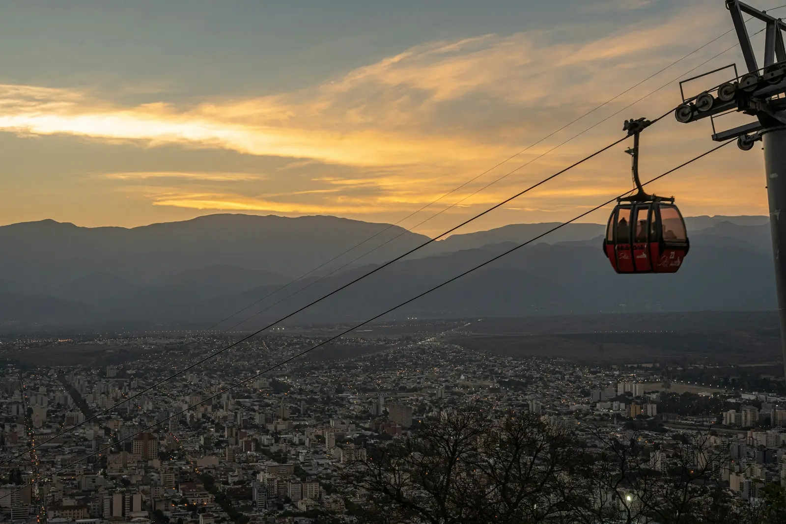
Salta
Salta is the capital of Salta province in northwest Argentina, a city of about 700,000 people at 1,187 m in the Valle de Lerma, served by the Martín Miguel de Güemes international airport. It is the base most travellers use for the high northwest: the Valles Calchaquíes and Cafayate to the south, the Puna to the west, and the Quebrada de Humahuaca across the provincial line in Jujuy. Sessions here mix a colonial city centre with mountain roads that climb fast. The old town is built around Plaza 9 de Julio. On one side stands the Cabildo, one of the few almost complete colonial cabildos in Argentina, whose arcades gave Salta its porticoed square and which now houses the Museo Histórico del Norte. Facing it is the Catedral Basílica, a Monumento Histórico Nacional that keeps the images of the Señor and the Virgen del Milagro. Two blocks away, the Basílica y Convento de San Francisco has a bell tower 54 m tall, painted in deep red and gold. The Museo de Arqueología de Alta Montaña (MAAM), at Mitre 77 on the plaza, holds the three Inca children found in 1999 on the summit of the Llullaillaco volcano and is closed on Mondays. Above the city rises the Cerro San Bernardo, a municipal nature reserve with the Monumento a Güemes at its foot. The Teleférico San Bernardo, opened on 12 December 1987, runs from Parque San Martín to the summit, where lookouts face the whole valley, an artificial waterfall drops over concrete terraces, and the city lights come on at dusk below the frame. The farther backdrop is the Puna. The Tren a las Nubes, run by a company owned by the province, leaves Salta by road at dawn and boards its train at San Antonio de los Cobres for the Viaducto La Polvorilla, above 4,200 m. Most clients are couples and families who give Salta three or four nights, wedding parties using it as a base for the valleys, and Salta families booking a fiesta de 15 in their own city.
Explore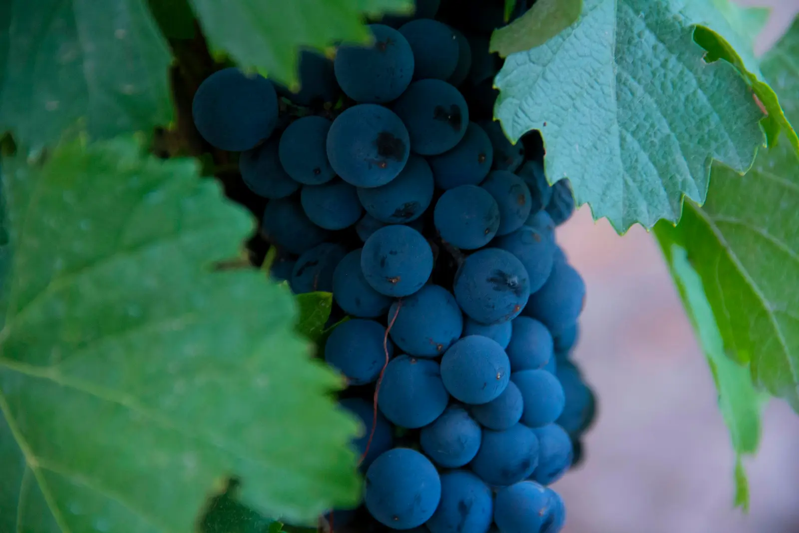
Valle de Uco
The Valle de Uco is a high wine valley in Mendoza Province, spread across the departments of Tupungato, Tunuyán and San Carlos at the foot of the Cordón del Plata and the Cordillera Frontal, roughly an hour to an hour and a half south of the city of Mendoza. It is where Argentina's newer high-altitude vineyards were planted, and the wine institute has followed the plantings with names: beyond the older department-level names such as Tupungato and San Carlos, the Instituto Nacional de Vitivinicultura (INV) recognised Vista Flores in 2012, Paraje Altamira in 2013, La Consulta in 2014, Los Chacayes in 2017, and Pampa El Cepillo and San Pablo in 2019 as geographic indications. The landscape is bigger and emptier than around the city. Wineries stand alone among their rows, often kilometres apart, with the mountains filling the whole western horizon and almost no buildings in between. Zuccardi Valle de Uco in Paraje Altamira, built of river stone and rock from its own ground, receives visitors only by reservation at 9:30, 11:00, 12:30 and 15:00. The Vines of Mendoza, a resort of 33 villas at km 11 of Ruta Provincial 94 in Los Chacayes, sits 90 minutes from Mendoza airport. Each property is private and sets its own terms for an outside photographer. Above the vineyards the valley climbs into protected land. The Manzano Histórico reserve, declared in 1994 and lying at 1,700 m about 40 km from the town of Tunuyán, marks the place where José de San Martín returned to the country through the Portillo pass. Further south, the Reserva Natural Laguna del Diamante holds a lake at 3,250 m under the 5,323 m Volcán Maipo, reached only in summer. Commercial photography in either reserve is applied for through the province. Most clients here are couples: destination weddings at a single winery for a whole weekend, elopements in the vines, and engagement sessions on the way to the mountains. Distances decide the plan. Guests sleep at the venue or nearby, the photographer stays in the valley the night before, and nothing is timed so tightly that a drive between two wineries breaks it.
Explore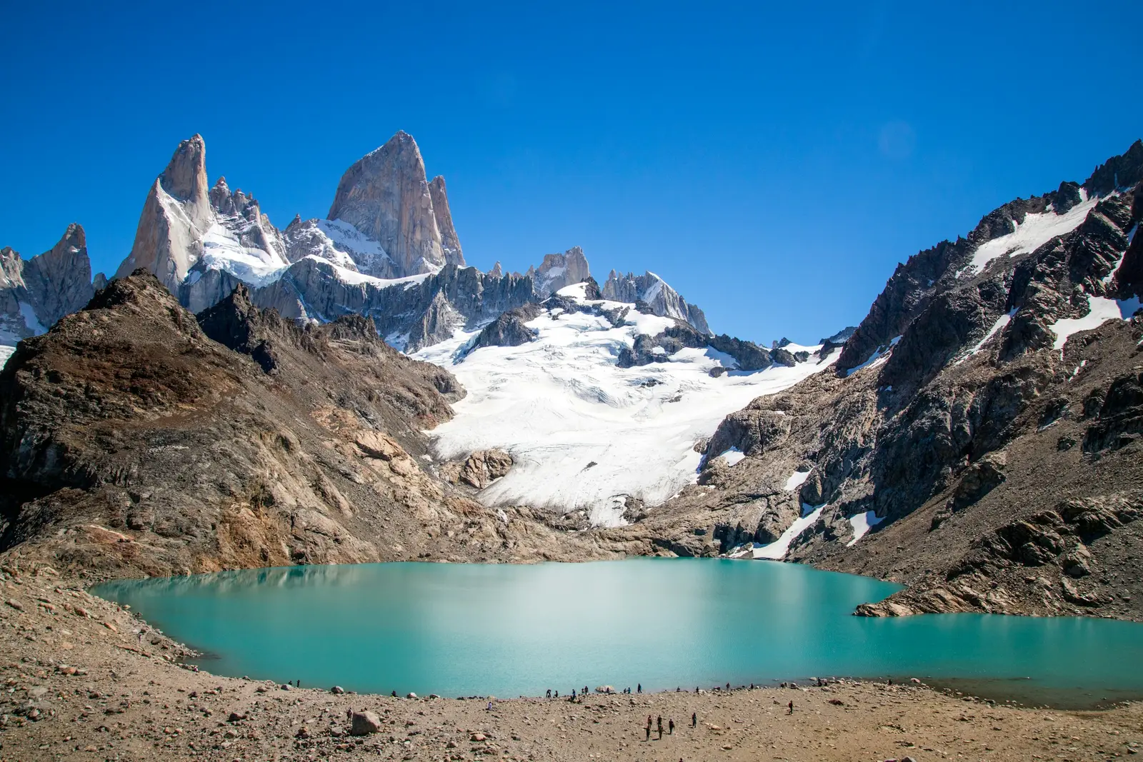
El Chaltén
El Chaltén is a mountain village in the north-west of Santa Cruz province, about 220 km north of El Calafate on paved road, at the edge of the Zona Norte of Parque Nacional Los Glaciares. The village was built for walking: the Administración de Parques Nacionales (APN) runs its trail network straight out of the streets, toward two granite massifs that stand above the forest. Cerro Fitz Roy rises to 3,405 m and was called Chaltén by the Tehuelche people, for whom it was a sacred mountain; Cerro Torre reaches 3,102 m across the valley. Photography here is hiking. The great viewpoints sit at the end of trails measured in hours, the weather on the peaks is not the weather in town, and the APN leaflet warns that there is little or no phone signal once the houses end. A session is planned as a walk with a camera: a start time fixed by light and wind, a turnaround time fixed by the return, and a second plan closer to town for the days when the mountains stay in cloud. The park rules shape every frame. Drones are forbidden in the Zona Norte, fires are not allowed anywhere in the park, pets stay out, bicycles are banned on the trails, and visitors walk only on marked paths. Camping is allowed only at designated sites such as Laguna Capri, Poincenot and De Agostini, and trekking or climbing in remote areas requires registration with the park. The huemul, an endangered deer declared a Natural Monument, lives in these forests, and an encounter means stopping, keeping quiet and keeping distance. Couples come for elopements and proposals under the peaks, hikers for a record of the trip they came to do, and creators for footage that looks like nowhere else. Most stay three nights or more, because the mountains show themselves on their own schedule.
Explore
Córdoba
Córdoba is the capital of the province of Córdoba and Argentina's second city, about 700 km northwest of Buenos Aires at the foot of the Sierras Chicas. It is a university city first: the Universidad Nacional de Córdoba traces its origin to the Jesuit college of the early 1600s, and students set the pace of the centre, the bars of Güemes and the lawns of Nueva Córdoba. The historic core is the Manzana Jesuítica, inscribed with the Jesuit estancias of the province on the UNESCO World Heritage list in 2000. The block holds the Iglesia de la Compañía de Jesús, the Colegio Nacional de Monserrat and the old university rectorate, now the Museo Histórico UNC at Obispo Trejo 242. The museum opens Monday to Friday from 9:30 to 17:30 and on Saturdays and holidays from 9:30 to 14:30, and its individual entry is free on Wednesdays. A short walk south, Avenida Hipólito Yrigoyen runs past the city's second set of backdrops. The Paseo del Buen Pastor, a former women's prison turned cultural centre at number 325, runs a dancing-water show every hour from 17:00 to 21:00. The Palacio Ferreyra, now the Museo Superior de Bellas Artes Evita at number 511, opens Tuesday to Sunday from 10:00 to 17:30. Clients here are largely Argentine: couples marrying with family from across the province, fiestas de 15, and a steady calendar of congresses, since the municipality counts more than 500 events a year in the city. Indoor heritage sites set their own rules for professional cameras, and those rules are confirmed in writing before the date.
Explore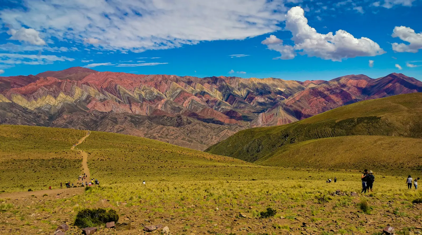
Quebrada de Humahuaca
The Quebrada de Humahuaca is a mountain valley in the province of Jujuy, in the far northwest of Argentina, cut by the Río Grande and followed by Ruta Nacional 9 from San Salvador de Jujuy north toward Bolivia. UNESCO inscribed it as a World Heritage cultural landscape in 2003, for the way centuries of settlement, farming and trade routes sit inside a landscape of coloured mountains. Sessions here are planned village by village, along one road. Purmamarca, a short detour west on Ruta Nacional 52, is the first stop for most travellers. The village is a Lugar Histórico Nacional, declared in 1975: whitewashed adobe houses, a church and its atrium on the plaza, and behind them the Cerro de los Siete Colores. Maimará, 71 km from San Salvador de Jujuy on Ruta 9, faces the Paleta del Pintor, a ridge of painted strata seen from a roadside lookout, with a hillside cemetery beside it. Tilcara holds the Pucará de Tilcara, the largest pre-Hispanic settlement in the Quebrada and a Monumento Histórico Nacional since 2000. It covers about 18 hectares, has some 600 stone enclosures linked by paths, and was remodelled by the Inca in the fourteenth century. Further north, beyond the town of Humahuaca, a gravel road climbs to the lookout over the Serranía de Hornocal, a mountain front of zigzag colour bands run by the Comunidad Aborigen de Hornocal. This is a lived-in landscape: the villages, the farmland and the archaeological sites belong to communities who still use them, and some places are sacred to them. Most of our clients come for two or three nights from Salta or San Salvador de Jujuy: couples, eloping pairs, travellers and content creators, who give the Quebrada its own days rather than a single excursion.
Explore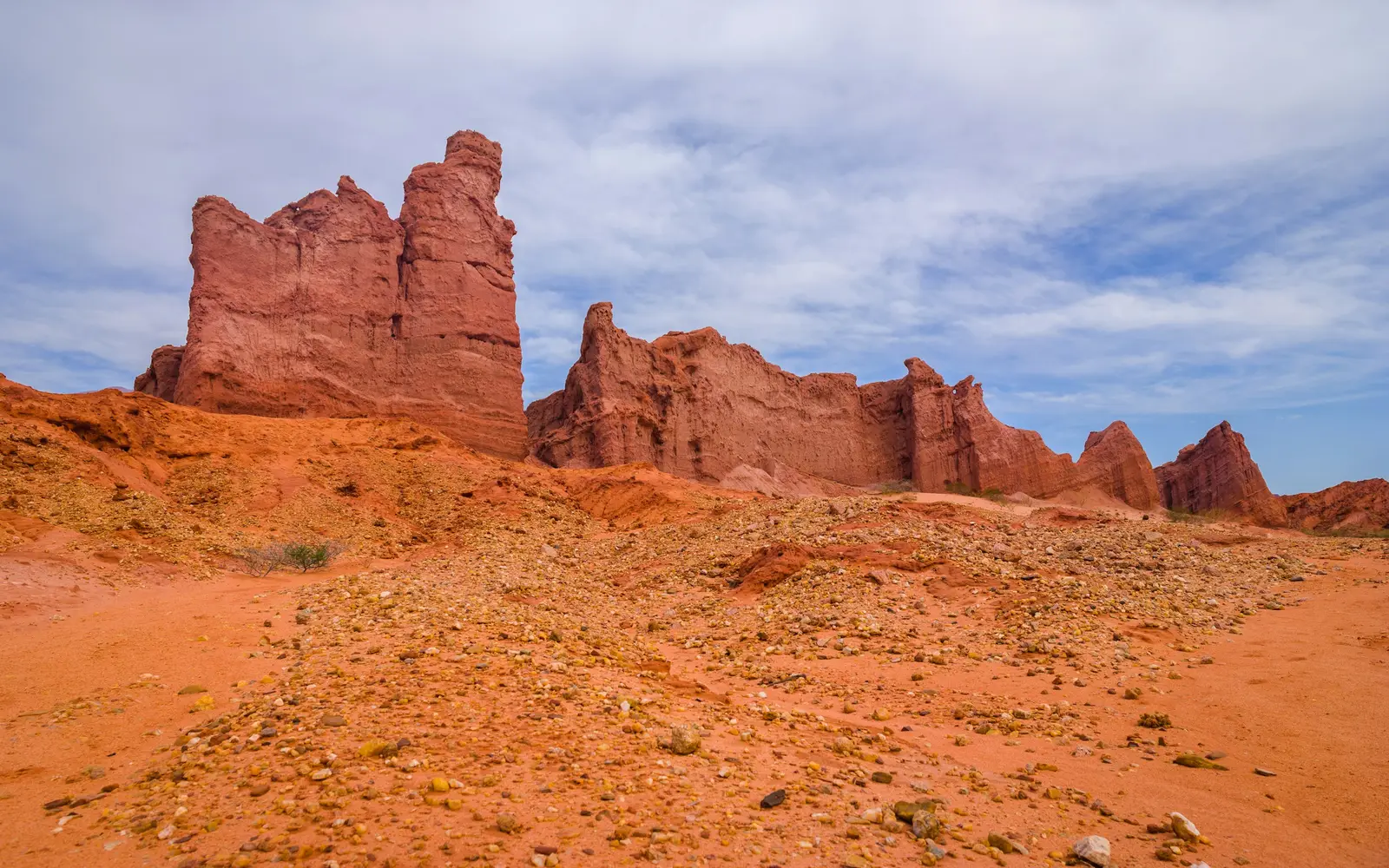
Cafayate
Cafayate is a wine town in the south of Salta Province, in the Valles Calchaquíes, where Ruta Nacional 40 meets Ruta Nacional 68 about 193 km south of the city of Salta. Its vineyards are high: Bodega El Esteco, at the junction of the two routes, gives its own vineyards as 1,700 m above sea level and some of its plots at 2,000 m. The Instituto Nacional de Vitivinicultura registers Cafayate, or Valle de Cafayate, as a geographic indication. The road in from Salta is half the reason people come. North of town, Ruta Nacional 68 follows the Río Las Conchas for 72 km through the Reserva Quebrada de las Conchas, created by provincial Ley 6808 in 1995 over about 25,000 ha. Its rock, laid down between 60 and 90 million years ago, is coloured red by iron oxide and carved by water and wind into formations with names: the Garganta del Diablo, the Anfiteatro, Los Castillos, El Sapo, El Fraile. The provincial rangers ask visitors to stay on marked paths, and fires, painting the rock and off-road driving are prohibited under the province's protected-areas law. The light here is high-altitude light: hard, clear and bright from mid-morning, with deep shadows in the gorges. Sessions in the quebrada are planned for the low sun of early morning or late afternoon, when the walls glow and the canyon floors fill with reflected warmth. In town the plaza, the cathedral and the low adobe houses make a gentler backdrop, and the vineyards come right up to the edge of the streets. Clients are mostly travellers on a road trip through Argentina's north-west: couples, honeymooners and small weddings at a bodega or a wine hotel, and wineries and hotels commissioning their own photography. Each winery and hotel is private and sets its own terms for an outside photographer, confirmed in writing.
Explore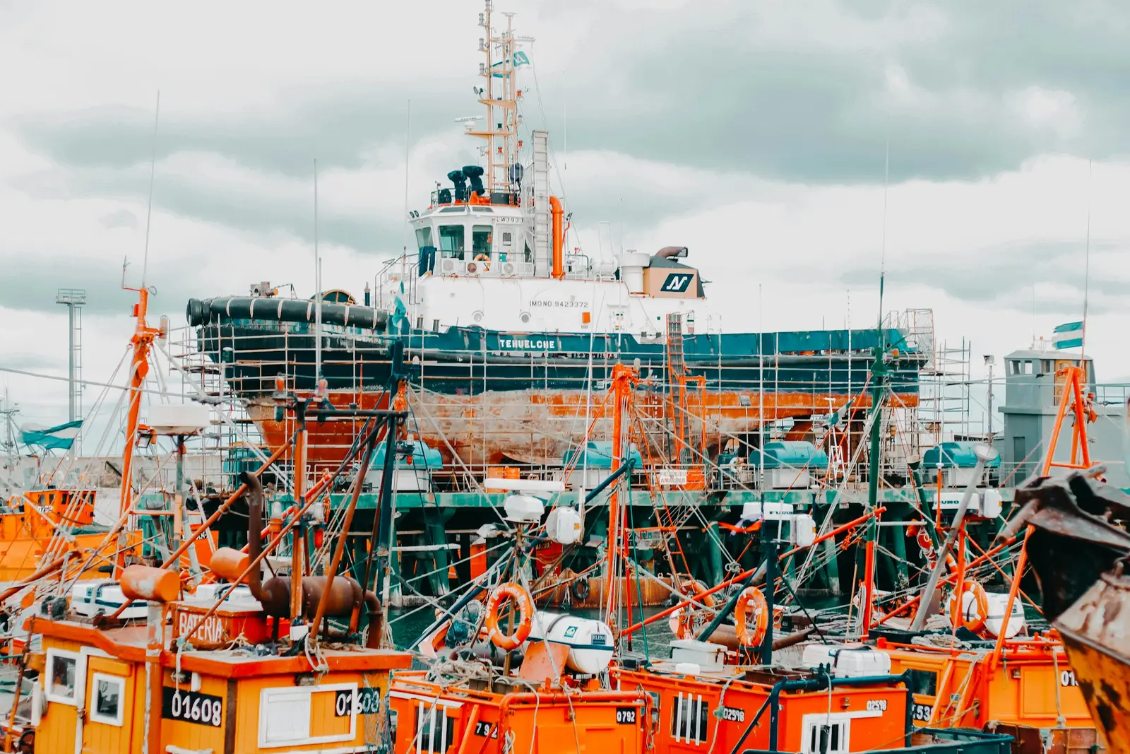
Mar del Plata
Mar del Plata is the Atlantic resort city of the province of Buenos Aires and the seat of the Partido de General Pueyrredon, about 400 km south of the capital, or a 45-minute flight to the Aeropuerto Internacional Ástor Piazzolla. Patricio Peralta Ramos founded the town on 10 February 1874, and it grew into the country's summer capital, a city of rocky headlands, stone villas and long beaches facing east. The coast is public land managed by the municipality. The Ente Municipal de Turismo y Cultura (EMTUR) administers 50 Unidades Turísticas Fiscales along 47 km of shore, and most of them operate as balnearios with tents, umbrellas and restaurants under a concession granted by ordinance. Inside a balneario, the concessionaire decides who sets up a camera; on the open sand between them, nobody does. The city's photographs come from its rocks and its buildings as much as its sand. The Torreón del Monje, a mock fortress on the rocks at Punta Piedras, was commissioned by Ernesto Tornquist from the German architect Karl Nordmann and donated to the city. Along the Rambla, Alejandro Bustillo's Casino and Hotel Provincial frame the Playa Bristol, and the port, with its sea lions and orange fishing boats, sits to the south. Most of our clients here are Argentine families and couples on holiday, plus weddings at the coastal event venues and owners photographing summer houses before the season. Each balneario or venue is asked for its policy in writing before the date.
Explore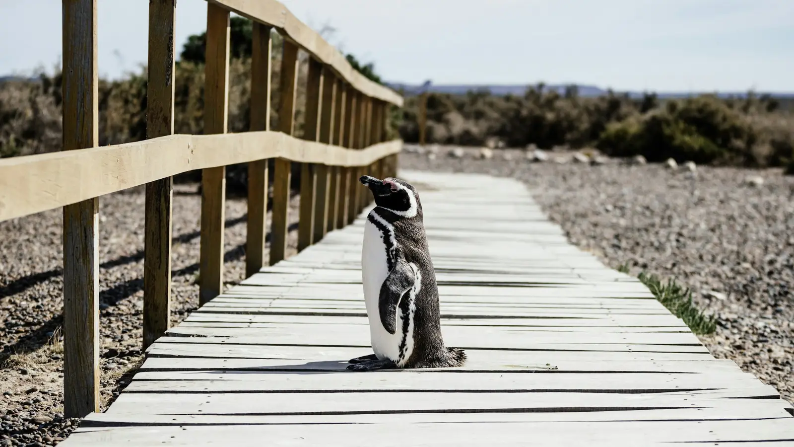
Puerto Madryn
Puerto Madryn is a coastal city in the province of Chubut, in Argentine Patagonia, on the Golfo Nuevo. It was founded in 1865 when the first Welsh settlers landed there, it is the national capital of diving, and it is the main gateway to the Área Natural Protegida Península Valdés, declared a UNESCO World Heritage Site in 1999. The El Tehuelche airport is 10 km from town, and Trelew is 67 km away. The animals set the calendar. Southern right whales arrive in the waters around the peninsula in mid-May, are most numerous in September and October, and have almost all left by late December. Magellanic penguins nest on the coast from mid-September to mid-April, elephant seals are present from July to March, and orcas hunt along the peninsula beaches in autumn and again in October and November. Three protected areas are within reach. El Doradillo, a municipal reserve created in 2001, runs 25 km along the coast north of town, where whales come within metres of the beach. Punta Loma, a provincial fauna reserve since 1967, watches a sea lion colony from a cliff 14 km south. Península Valdés begins at the Istmo Carlos Ameghino, where an interpretation centre sits by the road; Puerto Pirámides, about 100 km from Madryn, is the only village on the peninsula and the only place where boat trips go out to the whales. Most clients come for three or four nights between June and December: families on a Patagonia trip, couples and travellers who came for the whales, and proposals planned on the beach. Distances are long and roads inside the peninsula are gravel, so a session is usually tied to a single area per day.
Explore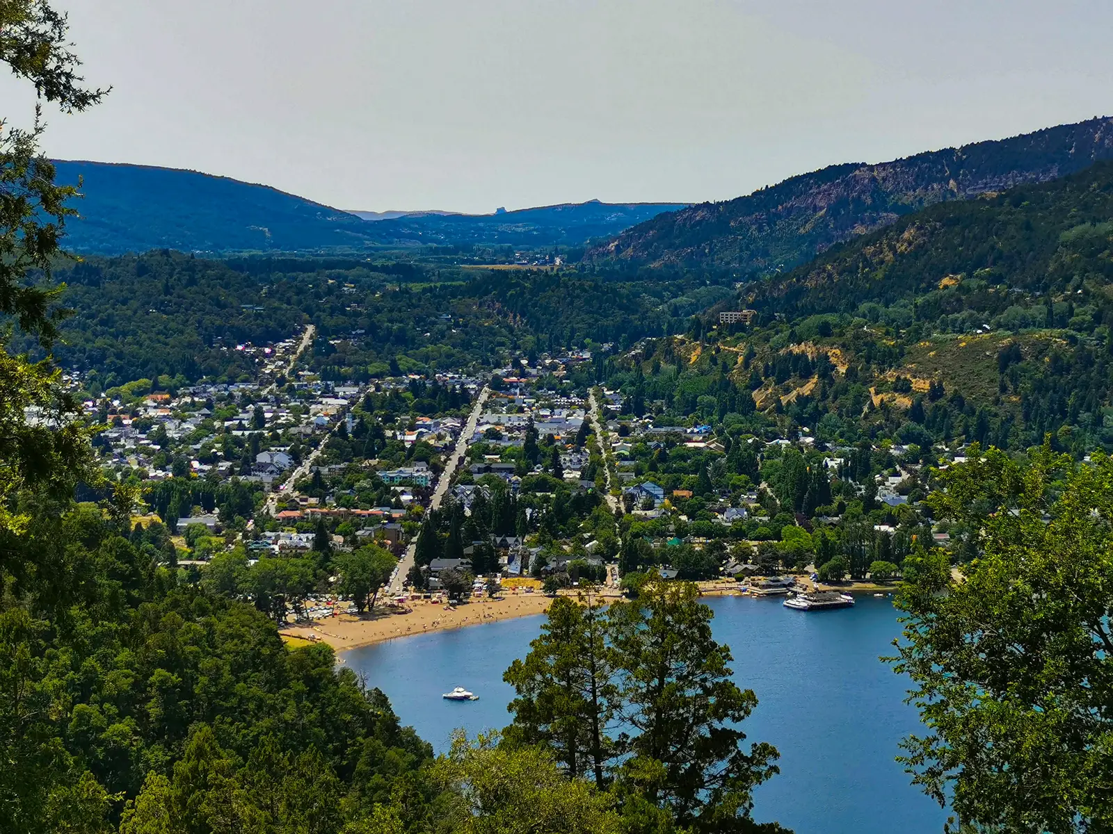
San Martín de los Andes
San Martín de los Andes is a mountain town in the Argentine province of Neuquén, set in a valley at the eastern end of Lago Lácar and surrounded by the Parque Nacional Lanín. The park conserves 412,000 hectares of Patagonian forest, steppe and high Andes, according to the Administración de Parques Nacionales (APN), and its Intendencia is in town at Perito Moreno 1006. The town is compact and walkable, which suits short sessions. The costanera runs along the lake with a beach, water sports and cafés. The former building of the park Intendencia stands opposite the Plaza San Martín on calle Emilio Frey and now houses the park's information centre and museum, and the Museo Primeros Pobladores occupies a timber building with a pitched roof in the style of the 1930s. Beyond town, the municipal tourism office lists day circuits to Lago Lolog and Lago Curruhué, to Yuco, Nonthué and Hua Hum, and to Lago Huechulafquen at the foot of Volcán Lanín. Leaving town usually means entering the park. The APN charges a daily access fee in Lanín — ARS 35,000 general, ARS 15,000 for Argentine nationals and ARS 8,000 for Neuquén residents from 1 June 2026 — and its 2021 drone regulation bans recreational flights in every national park and requires prior authorization for any project that flies one. Private land inside the park and its reserve is built under APN rules of its own, which matter to anyone photographing a property for sale. Most clients are families on holiday, couples, and small weddings at the lodges and estancias around the lake, plus owners listing a house or a lot near town. Each lodge sets its own rule for outside photographers, which is confirmed in writing before the date.
Explore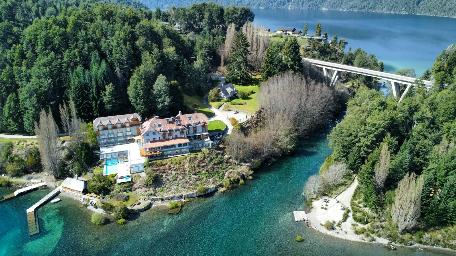
Villa La Angostura
Villa La Angostura is a lakeside town in the Argentine province of Neuquén on the northern shore of Lago Nahuel Huapi, at the neck of the Quetrihué peninsula, which holds the Parque Nacional Los Arrayanes. The park was created in 1971 as a protected area separate from the Parque Nacional Nahuel Huapi, conserves more than 1,700 hectares, and protects arrayán trees more than 650 years old and over 15 m tall, according to the Administración de Parques Nacionales (APN). The town is small and spread out through the forest, so sessions are planned stop by stop rather than street by street. The APN office and the park rangers sit in a small wooden house at Bahía Brava, where the trails into the peninsula begin: 12 km on foot or by bike to the arrayán forest, or just over a kilometre up to the Mirador Brazo Norte. At the other end of town, the Río Correntoso runs for roughly 200 m between Lago Correntoso and Lago Nahuel Huapi and is one of the shortest rivers in the world. The rules that matter most are the park's. The APN charges its daily access fee at the entrance to the Quetrihué peninsula — ARS 35,000 general at the time of checking — and sets entry cut-offs for the forest trail that change with the season. Its 2021 drone regulation bans recreational flights in every national park and forbids flying over private properties or settlements inside one without their prior consent. Most clients are couples: elopements and small weddings at the lodges along the shore, honeymooners who came for the quiet after Bariloche, and second-home owners selling or renting a house in the forest. Each lodge sets its own rule for outside photographers and for ceremonies on its lawn, and that is confirmed with the lodge before the date.
Explore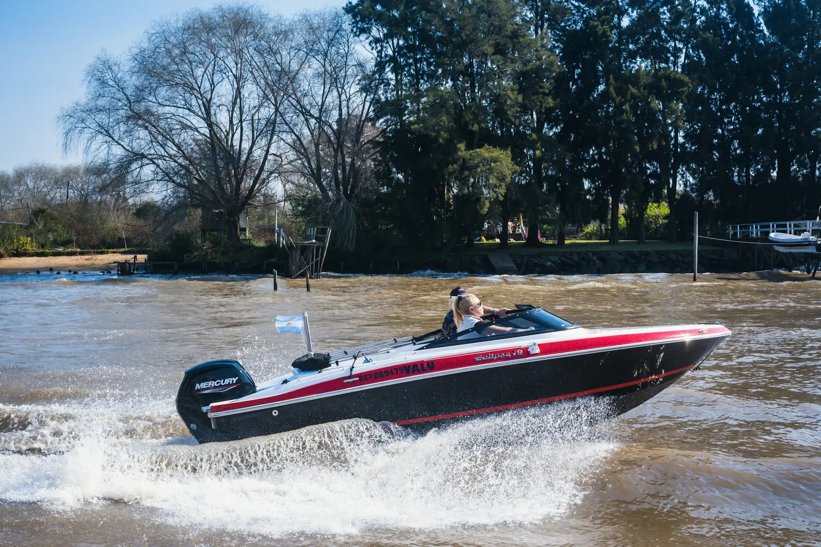
Tigre
Tigre is a river town and district of Buenos Aires Province, about 30 km north of the capital, built where the Luján, Tigre and Reconquista rivers meet the islands of the Paraná Delta. Its mainland half is a town of rowing clubs, a riverside promenade and the old Tigre Club building, now the Museo de Arte Tigre. Its island half is the Delta itself: wooded islands, weekend houses and inns reached only by water, either on the shared lanchas colectivas that leave from the river station or on a private boat. The Mitre railway line runs from Retiro to Tigre, and the trip takes about an hour. That split shapes every session. On the mainland, couples and families work along the Paseo Victorica, past the clubhouses that line the Luján, and around the museum gardens. In the Delta, the session is planned around a boat: how the photographer gets to the island, where the boat can tie up for the golden hour and when the last lancha leaves. Wedding venues and lodges on the islands run their own boats for guests and suppliers, and that timetable becomes the wedding timeline. Most of the ground that matters here is private. The rowing clubs are member clubs, the island venues and inns are businesses, and the museum sets its own rules for photography on its terraces, so each one is asked before the date. The Municipio de Tigre handles the public promenades. Drones are regulated nationally: under ANAC's RAAC Part 101, a drone of 250 g to 25 kg needs no prior authorization in the Open category, but it may not enter an aerodrome control zone, and the Aeropuerto Internacional de San Fernando is in the neighbouring partido, so every flight over the town is checked against the airspace map first. Clients here are couples and families on a day trip from Buenos Aires, Argentine couples marrying at Delta venues, and owners selling or renting island houses and riverside property.
ExploreSan Antonio de Areco
San Antonio de Areco is a town of the Buenos Aires pampas on the Río Areco, about 110 km north-west of the capital along Ruta Nacional 8, and the place Argentina associates with the gaucho. Ricardo Güiraldes set his 1926 novel Don Segundo Sombra here, the municipal Museo Gauchesco has kept its collection since 1938, and the Fiesta de la Tradición has been held every November since 1939. The town calls itself the Capital Nacional de la Tradición, and in 2026 it celebrates the centenary of the novel. The old centre is heritage by decree. Decreto 1305 of 1999 declared a sector of the town and its railway station a bien de interés histórico nacional, and made national historic monuments of the Puente Viejo over the river, the parish church of San Antonio de Padua, the Casa de la Intendencia, the Parque Criollo with its museum and the Pulpería La Blanqueada, and the Paseo de la Estancia La Porteña. Low houses with iron grilles, corner almacenes, silversmiths' workshops and dirt side streets make the town itself the backdrop. Around the town lie the estancias, working and historic ranches that now host weddings, corporate days and guests overnight. Each sets its own rule for an outside photographer, and that is asked in writing before the date. The open countryside also widens the drone rules: under RAAC Part 100 as amended by Resolución ANAC 312/2026, any rotary-wing drone flying only over a rural zone is in the Open category whatever its weight, while over the town the Open category stops at 25 kg. Clients are couples marrying at estancias, families and travellers on a day out from Buenos Aires, hotels and estancias that need images to sell rooms, and companies bringing teams to the countryside.
Explore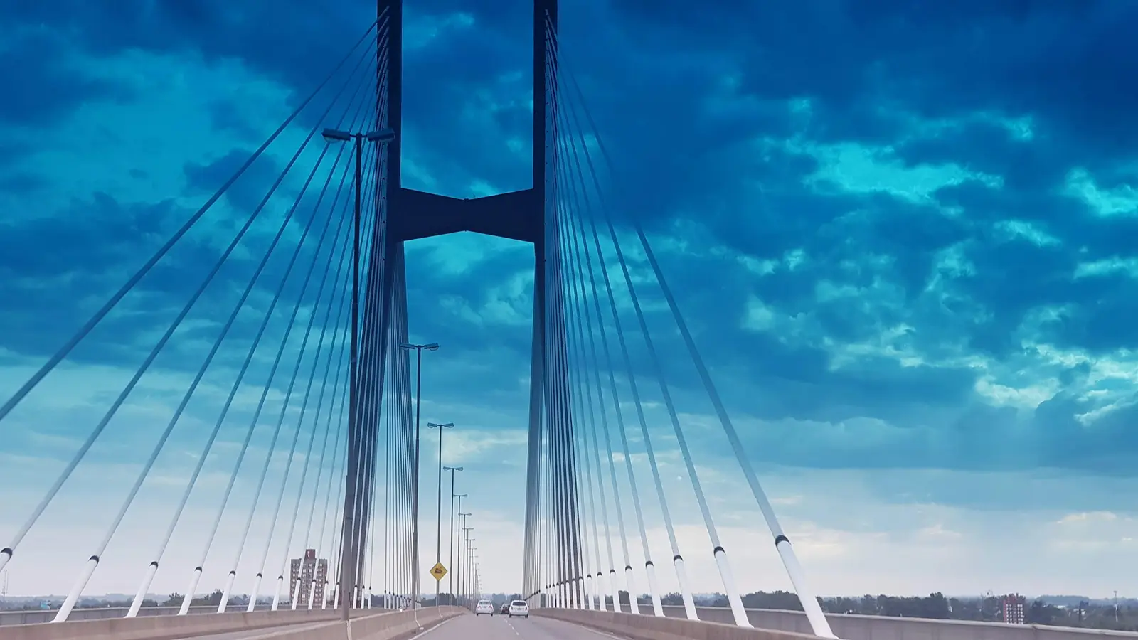
Rosario
Rosario is a river city in the province of Santa Fe, about 300 km northwest of Buenos Aires, built along the west bank of the Paraná. Its photographs are made on the riverfront: a long run of parks, piers and promenades that faces the islands of the Paraná delta across the water, with the city behind rather than in front. The landmark is the Monumento Nacional a la Bandera, inaugurated on 20 June 1957 after construction began in 1943. Ángel Guido and Alejandro Bustillo designed it, with sculpture by Alfredo Bigatti and José Fioravanti, and its tower, La Proa, stands almost 70 m high. The Galería de Honor de las Banderas de América opens from 9:00 to 19:00 Tuesday to Sunday, at no charge, and the lift to the mirador costs ARS 2,000 at the time of checking. Inland, the Parque de la Independencia is the city's green set. Carlos Thays laid it out around 1900 for the 1910 centenary, with a Rosedal, a formal Jardín Francés and a small lake with pedal boats, and the park is open to the public 24 hours a day. North of the centre, the Balneario La Florida puts a sand beach on the river itself, open every day from 9:00 to 20:00. Our clients here are mostly Argentine: couples marrying in the city, families with a fiesta de 15 to plan, and companies holding congresses at the Terminal Fluvial, whose convention rooms sit on the water a few metres from the monument. Weddings and events are confirmed with each venue in writing before the date.
ExploreCariló
Cariló is a forest village on the Atlantic coast of the province of Buenos Aires, in the Partido de Pinamar, about 360 km south of Buenos Aires. It was planted as a pine and eucalyptus forest on the dunes, and houses were built among the trees afterwards, so the place reads as a wood with a village inside it rather than a town with parks. That character is protected in writing. Cariló is a Paisaje Protegido de interés ecoturístico under provincial Ley 12.099, and Pinamar's Ordenanza 3361/06 lists what defines it: streets of selected sand and earth, a predominance of trees, minimal traffic, no public lighting and no overhead utility cables. The ordinance limits speed to 40 km/h on every street and bars commercial activity, shows and advertising from public spaces. For photographs, the forest is the set. Light comes through the canopy in shafts in the morning and late afternoon, and the sand streets between the trees carry no poles, wires or painted lines. The beach lies beyond a line of dunes that the ordinance forbids anyone to reshape, and only the stretches that already had balnearios when the provincial law was passed may stay under concession; the rest stay free and natural. Clients here are mostly Argentine families who return every summer, couples marrying at the hotels, and owners photographing houses for the rental season. Hotels and balnearios set their own rules for outside photographers, confirmed in writing before the date.
Explore


About these places
20 destinations in 12 provinces and the capital
- 20
- 12
- 2
- 1
This directory lists 20 places in Argentina where a session can be booked with a photographer who lives there: 18 cities and towns (Buenos Aires, Bariloche, Mendoza, El Calafate, Ushuaia, Puerto Iguazú, Salta, El Chaltén, Córdoba, Cafayate, Mar del Plata, Puerto Madryn, San Martín de los Andes, Villa La Angostura, Tigre, San Antonio de Areco, Rosario, and Cariló) and 2 regions that are not a single town (Valle de Uco and Quebrada de Humahuaca).
The distinction between a town and a region is not decorative. The Quebrada de Humahuaca is a valley of villages strung along Ruta Nacional 9 rather than a place with a centre, and the Valle de Uco is a wine valley where the vines in a photograph stand on a winery’s private land. In Patagonia the distance between the town and the view decides when a session can start: the Glaciar Perito Moreno is more than an hour’s drive from El Calafate.
What each page carries is what a visiting photographer would not know: which hour a location works, and who has the say over photographing there. In Argentina the answer changes within a single day — a national park run by the Administración de Parques Nacionales (APN), a provincial protected area such as Península Valdés, a municipality that sets the rules for filming in its public space, drone rules set by the Administración Nacional de Aviación Civil (ANAC), and the private owner of every winery, estancia and hotel. Where a fee is stated, the page names its source and the month it was last checked; where it cannot be sourced, the page says to ask rather than guessing.
Clocks matter too, in an unexpected way: all of Argentina keeps one time zone, three hours behind UTC, all year, without daylight saving. The clock in Ushuaia and in Puerto Iguazú therefore agrees while the sun does not — in December it sets well over an hour later at the southern end of the country than at the northern one. Each destination page also lists the areas covered from it at no travel charge, rather than giving them thin pages of their own, and names the nearby destinations a reader there plausibly also wants.